

Free Hydrology and Drainage Software — HEC-RAS, SWMM, EPANET and the Rest
Water engineering is one of the fields where free software is not merely "good enough" — it is the de facto professional standard. The core tools for river analysis, urban drainage and water networks were developed with American and Dutch public funding and are distributed free, with full source and documentation. Whoever pays for hydraulic software is in most cases paying for an interface around those same engines.
Rivers, channels and floods
1. HEC-RAS
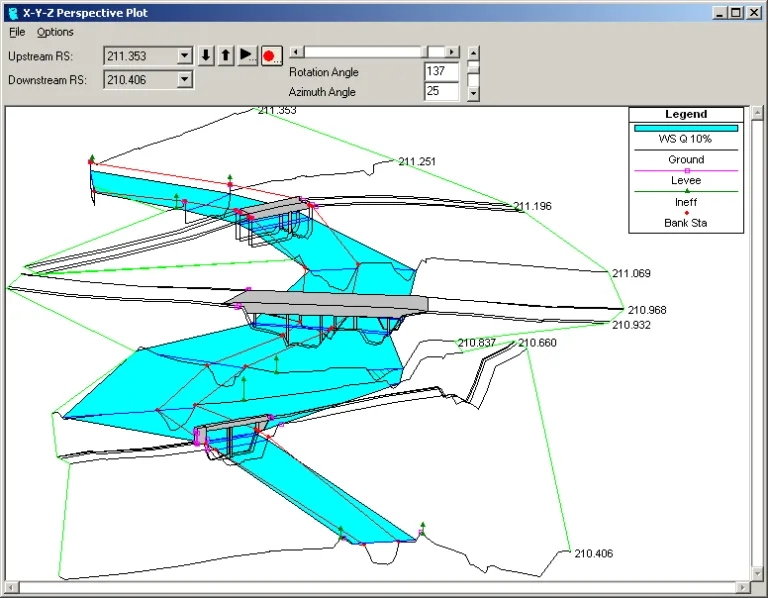
The standard tool for hydraulic analysis of rivers and channels: steady and unsteady flow, 1D and 2D, bridges and culverts, sediment transport and floodplain mapping. Developed by the US Army Corps of Engineers and distributed free, with complete documentation and reference manuals.
What is missing: it runs on Windows only, and geometry preparation still takes careful work. Preparation and display are easiest in QGIS.
2. HEC-HMS
The hydrological counterpart to RAS: turning rainfall into flow. Catchments, infiltration losses, unit hydrographs, routing through reservoirs and channels. Together the two cover the full chain from rainfall to water level.
What is missing: the built-in curves and parameters are American — CN values, loss methods, rainfall data. The method is sound; the numbers must be local.

HEC-RAS
US Army Corps of Engineers
1D/2D hydraulic model for rivers, bridges and culverts, with floodplain mapping. The world standard.
Get it from the vendor
HEC-HMS
US Army Corps of Engineers
Rainfall-runoff hydrological model — infiltration, unit hydrograph and routing. Pairs with HEC-RAS.
Get it from the vendorUrban drainage and water networks
3. SWMM
The EPA's urban drainage model: runoff, inlets, sewer and storm lines, detention storage and runoff quality, with full unsteady flow routing. This is the engine underneath a large share of the commercial products in the field.
4. EPANET
Pressurised water network analysis: flows, pressures, pumps, tanks, water age and quality. Here too the EPANET engine is the basis of many commercial products, and its API allows full automation from Python.

SWMM
US Environmental Protection Agency
Urban drainage model — runoff, sewers, detention and infiltration, including runoff quality.
Get it from the vendor
EPANET
US Environmental Protection Agency
Water distribution network model — flows, pressures and water quality. The engine behind most commercial tools.
Get it from the vendorCoasts, seas and morphology
5. Delft3D
From Deltares in the Netherlands — hydrodynamics, waves, sediment transport and morphology in coastal, estuarine and reservoir settings, open source. The tool you reach for when the question is how a marine structure will affect the shoreline.
6. TELEMAC-MASCARET
A French system for free-surface flow, 2D and 3D, with modules for waves and sediment. A full alternative to Delft3D for river and coastal flows.
7. SWAN
The standard wave model for coastal and shallow water — significant wave height, period and direction from wind, currents and bathymetry.
8. XBeach
Built precisely for the storm event: dune erosion, breaching and coastal flooding. This is the tool for coastal resilience questions.
Delft3D
Deltares
Coastal and marine engineering — currents, waves, sediment transport and shoreline morphology.
Get it from the vendor
TELEMAC-MASCARET
EDF / Consortium
Hydrodynamic system for rivers and coasts on unstructured meshes — flow, waves, sediment and quality.
Get it from the vendorSWAN
Delft University of Technology
Nearshore wave model for shallow water — essential input for jetty and breakwater design.
Get it from the vendorXBeach
Deltares
Storm impact on the coast — overwash, dune erosion and barrier breaching in a single extreme event.
Get it from the vendorWhat this looks like in practice
A typical drainage design workflow runs like this: QGIS to prepare the elevation model and delineate catchments, HEC-HMS to turn rainfall into flow, HEC-RAS to check the channel and map the floodplain, SWMM for the urban part, and QGIS again to present the result over a plan. The whole chain is free, and every step is documented well enough to defend in front of a regulator.
The point that always needs attention is the same one: the data and the standards must be local. The tools are American and Dutch; the rainfall curves, runoff coefficients and return periods are not.
All water and hydrology tools on the site: the hydrology and water category.