

Free GIS Software — What Really Replaces ArcGIS, and What Does Not
ArcGIS is the default in a lot of offices, and it is also one of the most expensive licences a civil or environmental engineer runs into. The practical question is not whether a free alternative exists — it does, and it is mature — but which part of your work actually depends on Esri.
Below are the free tools that genuinely hold up under professional workloads, with an explicit note on where each one stops.
The core: a GIS desktop
1. QGIS
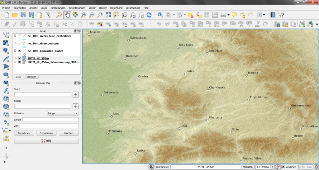
This is the real alternative. QGIS reads and writes almost every vector and raster format in existence (through GDAL/OGR), connects directly to PostGIS and to WMS/WFS servers, runs spatial analysis, and produces print maps through the Layout Manager. On top of that sits a large plugin library covering almost every niche need.
What is missing: an organisation with a decade of ModelBuilder models, ArcPy scripts and ArcGIS Enterprise infrastructure does not move that across without work. The official documentation is also weaker than Esri's, and most answers come from forums.
2. GRASS GIS
Older, less friendly, and very strong at raster analysis: elevation models, slopes, watersheds, viewsheds, soil analysis. Many of its functions are available directly inside QGIS through the processing toolbox, so in practice most people use it without ever opening its own interface.
What is missing: the interface and terminology (Location, Mapset) differ from every other GIS, and there is a real learning curve if you work in it directly.

QGIS
QGIS.org
Open-source GIS for spatial analysis, layer work and map production.
Get it from the vendor
GRASS GIS
OSGeo
GIS with strong raster and terrain analysis — catchments, slope, visibility and elevation models.
Get it from the vendorWhen the data comes from a drone or a scanner
3. WebODM
Processes drone imagery into an orthophoto, a surface elevation model and a 3D model, in a browser interface. For earthwork volumes, tracking site progress or quickly mapping an area, it replaces cloud services billed per hectare.
What is missing: processing is demanding — a GPU and plenty of memory are the real requirement, and a set of a few hundred images will run for hours.
4. CloudCompare
The standard tool for point clouds: registration between scans, cloud-to-cloud and cloud-to-model comparison, difference computation and noise cleaning. Particularly useful for checking as-built against design.
5. Meshroom
Full photogrammetry from a series of photographs — camera positions, a dense point cloud, a mesh and a texture. Better suited to documenting a single element or a building facade than an open site.

WebODM (OpenDroneMap)
OpenDroneMap
Photogrammetry from drone imagery — orthophoto, elevation model, point cloud and textured 3D model.
Get it from the vendor
CloudCompare
CloudCompare Project
Point cloud and laser scan processing — registration, cleaning, as-built comparison and measurement.
Get it from the vendor
Meshroom
AliceVision
Turns a set of photographs into a textured 3D model — photogrammetry, free.
Get it from the vendorA helper tool
6. Earth Point
Conversion between coordinate systems and display of the point on a map. The basic conversions are free; some advanced tools on the site require a paid subscription.

Earth Point — coordinate converter
Earth Point
Converts between coordinate systems and shows the point on a map.
Get it from the vendorSo can you drop ArcGIS?
For most engineering work — yes. QGIS alone covers layer editing, spatial queries, database connections and professional map production, and GRASS fills in the raster analysis. The three places where people still get stuck are enterprise infrastructure (ArcGIS Enterprise / Portal), automation written in ArcPy, and a client who demands deliverables in a closed Esri format.
The practical conclusion: if you are independent, in a small office, or a student, QGIS is not a compromise. If you sit inside an organisation already built around Esri, the question is organisational rather than technical.
All free GIS tools on the site: the GIS category. If you also work with water, see the hydrology and water tools.