

WebODM — The Complete Guide: Free Drone Mapping and Photogrammetry
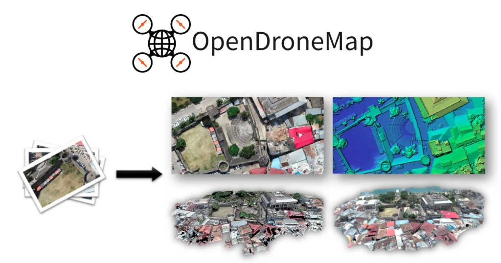
WebODM is the interface of the OpenDroneMap project — an open-source photogrammetry system that processes drone photos into mapping products. You upload hundreds of overlapping images and get an accurate map, an elevation model and a point cloud, without commercial photogrammetry software and without a cloud subscription.

WebODM (OpenDroneMap)
OpenDroneMap
Photogrammetry from drone imagery — orthophoto, elevation model, point cloud and textured 3D model.
Get it from the vendorWhat you get
- Orthophoto — a geometrically corrected photo map on which you can measure distances and areas.
- Elevation models — DSM (including buildings and vegetation) and DTM (ground), and contours.
- Point cloud — for use in CloudCompare or design software.
- Textured 3D model — for presentation and as-built documentation.
- Measurements — distances, areas and stockpile volumes directly in the interface.

CloudCompare
CloudCompare Project
Point cloud and laser scan processing — registration, cleaning, as-built comparison and measurement.
Get it from the vendorHow to get a good result
1. Fly at a constant height with high overlap (typically 70–80% front and side). 2. Fly when shadows are short and light is even. 3. Place surveyed ground control points (GCPs) — that is what turns a nice product into an accurate one. 4. Choose processing settings to suit the project size and your computer. 5. Check accuracy against checkpoints that were not used in processing.
Installation and licensing
WebODM is open source and free when self-installed — usually via Docker, on a local computer or a server. The developers also sell ready installers and a paid cloud service, for those who prefer not to install it themselves.
What's missing
Processing is heavy and large projects need a powerful computer with a lot of memory. Without control points, absolute accuracy is limited to the drone's GPS accuracy. And there are no built-in tools for drafting as-built drawings or advanced automatic classification — those are done in other software.
Who it suits
Surveyors, civil and geotechnical engineers, supervisors tracking site progress, farmers and authorities, and anyone with a drone who wants to produce maps from it.
Companion tools
QGIS for working with the orthophoto and elevation models, CloudCompare for point clouds and volume calculations, and MeshLab for processing the 3D model.

QGIS
QGIS.org
Open-source GIS for spatial analysis, layer work and map production.
Get it from the vendor
MeshLab
ISTI — CNR
Mesh and point cloud processing — hole filling, simplification, alignment and format conversion.
Get it from the vendorBottom line
WebODM gives professional photogrammetry without a licence — and with surveyed control points, the products are good enough for most engineering work.