

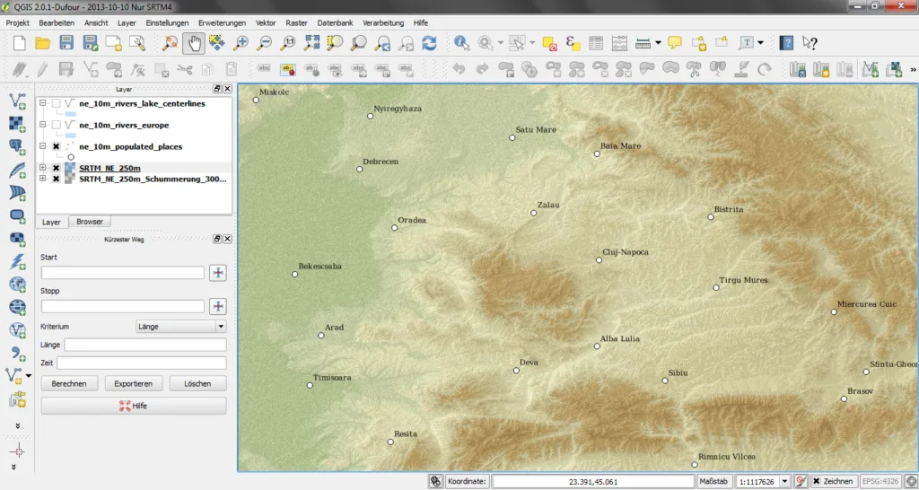
QGIS — The Complete Guide for Engineers: Maps, Coordinates and Spatial Analysis for Free
QGIS is a full desktop GIS, open source, running on Windows, macOS and Linux. It is used by authorities, infrastructure companies and design offices worldwide, and in many cases it is no longer the "alternative" to ArcGIS but the main tool. For an engineer, it answers the question of how to open a cadastral layer, an elevation model or a pipeline route without a licence.

QGIS
QGIS.org
Open-source GIS for spatial analysis, layer work and map production.
Get it from the vendorWhat you do with QGIS on an engineering project
- Coordinates and projections — conversion between WGS84, national grids and any other system, including on-the-fly reprojection of different layers on one map.
- Vector and raster — Shapefile, GeoPackage, DXF, KML, GeoTIFF, and online map services (WMS/WFS).
- Terrain analysis — slope, hillshade, contours and profiles from an elevation model (DEM).
- Hydrology — catchments and flow directions, through the Processing Toolbox that includes GRASS and SAGA.
- Print sheets — Print Layout with legend, scale bar, north arrow and coordinate grid, exported to PDF.
Plugins worth knowing
The strength of QGIS is its plugin repository. QuickMapServices adds basemaps and aerial imagery in one click. Profile Tool extracts a longitudinal section from an elevation model. qgis2web exports an interactive map for a website. For fieldwork, QField opens the same project on a phone and brings the survey back to the office.

QField
OPENGIS.ch
QGIS in the field — data collection on a phone or tablet, offline.
Get it from the vendorWhat's missing
There is no official support like Esri's, and some of ArcGIS Pro's advanced tools — complex utility networks, some advanced spatial analytics and shared enterprise-cloud workflows — need manual work or extra tools in QGIS. Native ArcGIS project files (.mxd, .aprx) do not open directly; the data itself does.
How to start properly
1. Download the LTR (long-term release) version for everyday work. 2. Set the project coordinate system before adding layers. 3. Save new data as GeoPackage rather than Shapefile. 4. Open the Processing Toolbox — that is where most analytical tools live.
Companion tools
GRASS GIS and SAGA GIS for heavy raster analysis, WhiteboxTools for hydrology and LiDAR processing, and GeoServer for publishing layers as a map service for an organisation.

GRASS GIS
OSGeo
GIS with strong raster and terrain analysis — catchments, slope, visibility and elevation models.
Get it from the vendor
SAGA GIS
SAGA Development Team
Advanced spatial analysis, especially on elevation models and terrain.
Get it from the vendor
WhiteboxTools
Whitebox Geospatial
Hundreds of geospatial analysis tools, especially strong on terrain and LiDAR point clouds.
Get it from the vendor
GeoServer
Open Source Geospatial Foundation (OSGeo)
A map server — publishes GIS layers as WMS and WFS services for any software.
Get it from the vendorBottom line
Every civil, environmental, transport or geotechnical engineer should have QGIS installed. It is the most useful tool you can get for free in the field.